Antarctica’s Ice Sheet Shrouds a Vast Landscape of Alpine Valleys and Ice Rivers


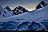
Some areas of Earth are less well understood than the surface of some worlds in our solar system. The landscape of Antarctica, under its immense ice cap, is one of them. Hidden from view, this buried terrain still conceals many secrets and revealing them could considerably improve our understanding of ice melt and sea level rise in a context of global warming.
Now, researchers from the University of Edinburgh and Dartmouth College have taken a major step towards discovering this hidden world. By combining high-resolution satellite data with current knowledge of the physics of ice flows, the team produced the most detailed map to date of Antarctica’s subglacial rock landscape. The new map reveals geological structures such as mountains, canyons and deeply carved rivers of ice, hidden under nearly three kilometers of ice.
Learn more: Observations of Antarctica’s Doomsday Glacier Reveal Cracked Surface
The secret landscape of Antarctica under a frozen leaf
The Antarctic ice sheet is vast, covering more than 5.4 million square kilometers, making it the largest on the planet. Beneath this frozen blanket lies a surprisingly complex world of mountains, valleys, plains, basins and even lakes – features that contrast sharply with the smooth, white surface above.
Surprisingly, the shape and texture of the land beneath the ice plays a crucial role in how the ice sheet moves, melts, and ultimately contributes to future sea level rise. Yet because Antarctica is so remote and difficult to access, much of this subglacial landscape remains a mystery.
In a new study published in ScienceResearchers indirectly mapped bedrock by analyzing the subtle imprints that mountains and valleys leave on the ice above them. By combining high-resolution satellite observations with physical models of ice flow, they were able to reconstruct parts of the landscape buried under kilometers of ice.
Lots of detail just looking at the surface
The result is a continent-scale map showing Antarctica’s hidden topography in never-before-seen detail, resolving features with sizes ranging from approximately 1.2 miles to 18.6 miles. According to the researchers, some of these structures could even date back to before the formation of the current ice sheet, around 14 million years ago.
Newly identified features include deep, narrow alpine valleys, eroded lowlands, and extensive buried river channels.
“It is perhaps very surprising that ultimately so many details of the bed topography – features such as glacial valleys, hills and canyons… – are captured in the shape of the ice surface so far above,” study co-author Robert Bingham said in a press release.
Bingham also noted that despite the presence of deep canyons beneath the ice, the surface expression is remarkably subtle, since the ice passing over it is nearly 3 kilometers thick.
“…the ice surface elevation typically only drops a few meters, a change that is barely noticeable when traveling on the ice surface itself,” Bingham said, emphasizing how impressive the detection is.
Clearest glimpse of a hidden landscape
Beyond producing a more accurate map, the newly resolved texture of Antarctica’s bedrock allows scientists to uncover patterns of glacier formation across the continent. This provides valuable information about how the ice sheet formed, how it evolves, and how it continues to interact with the land below, informing predictions about future ice dynamics, according to the release.
However, further research depends on even more defined technologies. In a related context Science In a perspective article, Duncan Young of the University of Texas Institute for Geophysics pointed out that the methods used in the current study rely on assumptions about complex processes that can vary significantly across the continent. In many regions, the boundary between ice and rock is fuzzy or constantly changing, making accurate modeling difficult.
Emerging technologies such as radar swath imaging, magnetotellurics, and seismic surveys could provide even richer data in the future, although they currently face logistical and spatial challenges. For now, the study offers the clearest glimpse yet into a landscape that has remained hidden for millions of years.
Learn more: The largest mountain range no one has ever seen lives beneath the Antarctic ice sheets
Article sources
Our Discovermagazine.com editors use peer-reviewed research and high-quality sources for our articles, and our editors review the articles for scientific accuracy and editorial standards. See the sources used below for this article:


