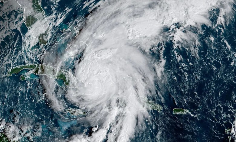
Hurricane Melissa winds hit record-breaking 252 mph, data confirms

Hurricane Melissa Wind gusts reached record speeds shortly before the storm made landfall in the Caribbean last month, according to data recorded during the deadly event.
The data was collected when a NOAA Hurricane Hunter aircraft dropped a fleet of weather instruments into the raging storm, according to a news release from the U.S. National Science Foundation’s National Center for Atmospheric Research. The devices, called dropsondes, are equipped with small parachutes and take between two and four readings per second before falling into the ocean.
Dropsondes are the only devices capable of simultaneously recording information on pressure, temperature, humidity and wind. The data is used in weather forecasts and warnings, including emergency alerts.
“When you’re looking at a Category 4 or 5 hurricane, you won’t have aircraft flying that close to the surface — that would be totally dangerous — but you need to know what’s happening near sea level, because that’s where people and property are most affected,” NSF NCAR engineer Terry Hock, who manages the Dropsonde program, said in the press release. “The dropsonde gives you information you can’t get any other way and that’s why it’s been around for decades.”
A drop probe used during Hurricane Melissa recorded a wind gust of 252 miles per hour shortly before it hit the ocean.

An NRD41 probe, like those dropped in Hurricane Melissa, with Hurricane Irma in the background. / Credit: Holger Vömel/NSF NCAR
NOAA researchers contacted NSF NCAR to confirm that this was the highest wind speed ever recorded by a drop probe.
“NOAA threw us for a loop when they saw the high wind speeds and asked, ‘Are these numbers good?'” said Holger Vömel, an NSF NCAR senior scientist who works with the organization’s Dropsonde program.
To verify the data, Vömel and other researchers examined the numbers with quality control software. They also confirmed that the reported 252-mile wind gust would have been physically possible and that it followed the behavior of the hurricane, as well as patterns from previous storms. The review confirmed that the wind gust measurement was accurate.
The previous fastest wind gust recorded by a dropsonde was in 2010, when Typhoon Megi unleashed a 248 mph blast over the western Pacific Ocean. During Hurricane Katrinaresearchers thought they had recorded an even stronger burst, but the data had significant problems, NSF NCAR said.

Hurricane Melissa is visible in a satellite image taken at 8:50 a.m. EDT, October 29, 2025. / Credit: NOAA/NESDIS/STAR GOES-19
“They have pilots and researchers who are literally risking their lives to obtain these measurements. They are heroes, and it is a privilege that we have to play a role in ensuring the accuracy of the measurements they acquire,” Vömel said.
Hurricane Melissa inflicted catastrophic damage in the Caribbean in late October. It made landfall in Jamaica as a Category 5 storm before progressing towards Cuba, the Bahamas, the Dominican Republic and Haiti. Dozens of people, mostly Jamaica and Haitiwere killed in the storm.
Teenager’s death on cruise ship could lead to criminal charges against family member
Trump blasts reporter during crown prince meeting on Saudi relations, questions about Khashoggi and Epstein
Massie on FBI, DOJ leaders being criminally liable if Trump doesn’t release all Epstein files


