Over a foot of snow forecast for tristate area as 26 million people under blizzard warnings

About 63 million people were under winter alert, from Tennessee to Maine as residents in cities like Philadelphia, Boston and New York expect between 9 and 20 inches of snow.
About 26 million people were under blizzard warnings in New York, New Jersey and Connecticut.
The storm is expected to take shape on Sunday, with heavy snow and strong wind gusts targeting the Mid-Atlantic, Northeast and Appalachians. Cold rain will continue across parts of the Carolinas to end the weekend.
Sunday evening conditions are favorable for rapid intensification off the Mid-Atlantic coast through Monday morning, which could bring intense wind gusts over 50 mph and bands of very heavy snowfall from the Mid-Atlantic to southern New England. The greatest impacts will be felt along the coast, where blizzard warnings are in effect from parts of Delaware to Connecticut.
Initial forecasts called for a few inches of snow, but the forecast took a turn for the worse Friday when cities began issuing blizzard warnings.
In New York, snowfall is expected to begin early Sunday morning and intensify in the afternoon and night, with up to 2 inches per hour possible overnight.
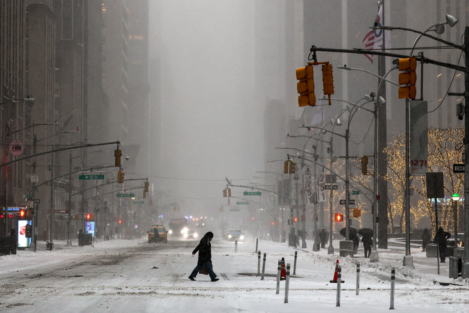
For New York City, this weekend’s storm would mark its first blizzard since 2016, Mayor Zohran Mamdani said during a press briefing Saturday. He warned the city could be buried under 20 inches of snowfall, making Monday’s commute “extremely dangerous.” The city’s “Code Blue” operations were activated to protect homeless New Yorkers, he said.
“I ask all New Yorkers to stay indoors and stay off the roads for your safety,” Mamdani said.
New York State Governor Kathy Hochul on Saturday declared a state of emergency in several counties, including Albany and New York, in anticipation of Sunday’s storm. Hochul also activated the state National Guard, which will assist in storm response operations.
New Jersey Gov. Mikie Sherrill declared a state of emergency effective midday Sunday as the state braces for 20 inches of snow. Blizzard warnings were also issued for the coast for the first time since 2022, Sherrill said during a briefing Saturday.
Sherrill urged residents to stay home and stay off the roads.
“That means today is the perfect time to get the water you need, to get the food you need, to go to the grocery store so you can stay off the roads tomorrow and Monday,” she said.
The Washington, D.C. and Baltimore area is expecting 3 to 6 inches of snow, most of which will fall Sunday evening.
Most of the snowfall is expected to stop by Monday evening. Monday morning, bands of heavy snow are expected to begin the day along the Interstate 95 corridor connecting DC to Boston.
These snow showers will gradually cease throughout the day, lingering last in parts of Massachusetts and Maine. Although the snow will decrease, breezy winds will persist throughout the Northeast.
This snowstorm is arriving in the region just as ice from a previous system was melting late last month. The system affected much of the United States and was responsible for the deaths of at least 50 people, including more than 10 people in New York.
Mamdani warned that this weekend’s storm could be worse for the city than the last one.
“These conditions could become even more dangerous than what we faced last time,” Mamdani said, noting that the city could receive 6 inches of snow or more than last time.
The city put out an emergency call for snow shovelers Saturday to help clear streets of snow and ice, according to City Comptroller Mark D. Levine.
Amtrak announced it would adjust some of its routes Sunday and Monday “due to hazardous weather conditions.” The service did not specify which routes would be affected, but said “customers will be directly informed of any cancellations or adjustments.”


