Brian Hooker shared maps he says show where his wife went missing in the Bahamas

Brian Hooker sent images of maps to his friends and other boaters, telling them the drawings purportedly showed where his wife, Lynette, was going. missing in the Bahamas last week. He also allegedly sent them to law enforcement.
Brian Hooker shared the footage with friends, who gave it to CBS News, in the days after his wife’s disappearance and during initial search and rescue efforts. He told his friends he was drawing on the maps to help the search and rescue team.
The footage may provide the most detailed account of Brian Hooker’s version of the events of that night.
Lynette Hooker, a native of Michigan, was missing since Sunday.
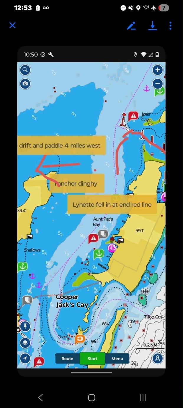
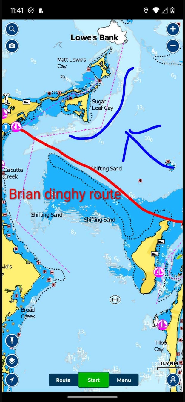
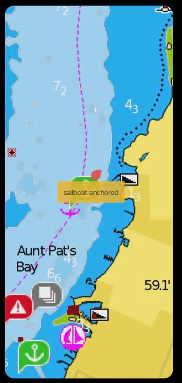
The images appear to be screenshots from Navionics, a GPS app that boaters use to navigate, drawn to mark areas such as the alleged dinghy route the night Lynette Hooker disappeared and Brian Hooker claims she went overboard.
Hope Town Fire and Rescue would not comment on the footage, citing the ongoing investigation. The Royal Bahamas Police Force did not immediately respond to CBS News’ request for comment.
According to the screenshots, Brian Hooker traveled 4 miles west in his canoe from the point where Lynette Hooker allegedly went overboard.
His wife reportedly went overboard around 7:30 p.m. and, according to Brian Hooker’s account to investigators, he washed ashore at 4 a.m. the next morning at the Marsh Harbor shipyard.
Bahamian officials arrested Brian Hooker Wednesday evening for questioning. He has not been charged with any crime, according to his attorney, Terrel Butler.


